In July we had an extremely mixed forecast. We had the hottest day on record one week, and then experienced huge thunderstorms and heavy rain the next. The thunderstorms occurred during the late evening and throughout the night, and at its peak 22,000 customers were without electricity. Fortunately, we had planned ahead and worked around the clock meaning that by 8am the next morning, nearly all customers were restored.
We are all hoping for some drier weather throughout August, particularly in respect to the ongoing work at Toddbrook Reservoir in Whaley Bridge. Paul Mott, Senior Meteorologist from MeteoGroup provides us with more details on what we can expect as the month progresses.
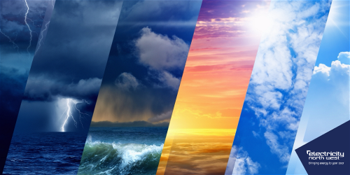
A look back at July’s weather
July experienced an assortment of weather across the region, including record-breaking temperatures and spectacular thunderstorms, culminating in heavy downpours and local flooding.
The first eight days of the month were often dry thanks to a nearby area of high pressure. The weather was then rather mixed for the next week or so with bands of rain alternating with drier, sunnier days. It then became much wetter from Wednesday 17th to Sunday 21st before a heatwave developed as hot air spread from Spain and northwest Africa the following week.
The heatwave then broke down for the final days of the month as fresher and much wetter conditions spread from the west. Downpours at the end of the month caused local flooding with a landslip on the Carlisle to Settle railway line.
Northwest England experienced heatwave conditions on Tuesday 23rd and Thursday 25th with temperatures exceeding 30 Celsius quite widely on the 25th. One of the hottest locations in northwest England was Rochdale, with a high of 33.9C, which smashed its previous record of 31.2C (set in the heatwave of August 2003). Carlisle also experienced its hottest day on record with a high of 32.4C, beating its previous record of 31.4C. The heat also sparked some spectacular thunderstorms during the early hours of Wednesday 24th.
Overall, July 2019 was wetter than normal for the time of year with approximately 120mm of rain falling (around 150% of the July average) although some locations experienced much more rain. Sunshine totals for July reached around 160 hours, a little above normal. Temperatures through the month were highly variable but the mean maximum and minimum were approximately 1C above normal for July, at 21C and 14C respectively.
A look ahead to August
The mixed theme to this summer’s weather is likely to continue through August.
The first two-thirds of the month are likely to be wetter than normal for the time of year as rain-bearing low pressure areas approach from the northeast Atlantic. Showers and rain are likely to be occasionally accompanied by brisk winds. However, we should also experience some brighter and warm interludes.
Later in the month, there are signs that those rain-bearing low pressure areas should move further away to the north. This should mean we see more frequent drier and warmer days through the latter part of August. However, as always, there is uncertainty in the details of any forecast more than a week in advance. There are likely to be a few tropical storms or hurricanes near to the Caribbean or USA in August. The remnants of one or two of those tropical cyclones could approach the British Isles, bringing the chance of one or two very wet and breezy days even later in the month.
In the event of an unexpected power cut you can contact Electricity North West 24/7 on the free national number 105 or call 0800 195 4141 or let us know on Twitter or Facebook.
If you need extra support, sign-up to our Priority Services Register. To discover more about the extra support on offer watch our Priority Service video here.